There is an obscure corner of the Earth that sends explorers out into the world..

Karl Kraus, 1909

Follow us on

Latest news from our blog

  • Default
  • Title
  • Date
  • Random
load more hold SHIFT key to load all load all

The real voyage of discovery consists not in seeking new landscapes, but in having new eyes. 

Marcel proust

The expedition, held in February 2009, had the goal to expand the cognitive framework of the karstic phenomenon in the quartz limestone of Venezuela, in particular regarding the hydrogeological, speleogenic and biospeleological point of view.
Specific target were the eastern offshoots of the vast Chiamanta Tepui, a range covering an area of nearly 1200 km2, topographically divided in several minor peaks, including Akopàn and Churì. Here, during a pre-expedition held in January 2008, we spotted several important cave entrances, some characterized by impressive resurgences on the walls.
The main problem we had to deal with was arriving to the cavities, which open on the high walls of the Akopàn Tepui, tackling challenging descents of almost 200 meters. It was essential using the helicopter to reach the top of the mountain, transporting one small autonomous team at a time.
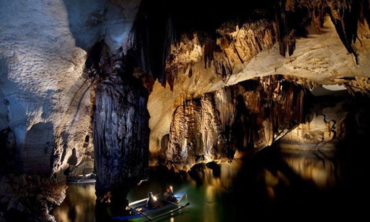
During the expedition we collected an impressive photo and video documentation. For the first time in a speleological expedition we used the Inmarsat satellite system by Intermatica. This equipment allowed us to update, daily and in real time, a news page. Among the main explorative results, we explored the Akopàn-Dal Cin-Maripak system, with a 3,5 km development on huge active galleries.
During the expedition, the Venezuelan helicopter pilot Raul Arias spotted a large entrance in the highest plateaus of the Auyan Tepui. The cave was called Cueva Guacamaya and was explored a few weeks later by Arias, two Italian speleologists and a Venezuelan speleologist, Freddy Vergara.

All our explorations

  • Tepui: Explorations at the gates of time Amazonas, border with Brazil and Venezuela - Research on the plateaus of the Amazon basin, through ancient caves, vertiginous walls and impenetrable forests. Geographical
    Read More
  • Palawan, Philippines - The research in the large subterranean estuary of Palawan Island, among long dark lakes, plentiful biology and tropical forests. Geographical area: the island of Palawan, southern-western Philippines, a
    Read More
  • PATAGONIA: GLACIER HYPER-KARST AND EXTINCT POPULATIONSExplorations between crystallized vortices of the Hielo Continental and lost populations.South America is a strip of land that juts out into the vast Southern Ocean,
    Read More
  • SAMARKAND: GIANT REEFS IN A SEA OF SANDExplorations in the deepest caves of Asia, on giant peaks of the Pamir-Alaj Mountains, one of the scenes of the collapse of the
    Read More
  • ALPINE GLACIAL KARST: THE SHAPE OF WATER-HOLESExploration project of “water-holes”, cavities created by melting within large glaciers.Our association has worked on glaciers all over the world for over 20 years
    Read More
  • Temples and underground rivers of the distant Myanmar Geographical Area: Indocina peninsula - Myanmar - Shan State, Central-Eastern Myanmar, about 700 km north-east of Yangon. The peninsula of Indochina contains some of
    Read More
load more hold SHIFT key to load all load all

Questo sito o gli strumenti terzi da questo utilizzati si avvalgono di cookie necessari al funzionamento ed utili alle finalità illustrate nella cookie policy. Se vuoi saperne di più o negare il consenso a tutti o ad alcuni cookie, consulta la cookie policy. Cookie policy